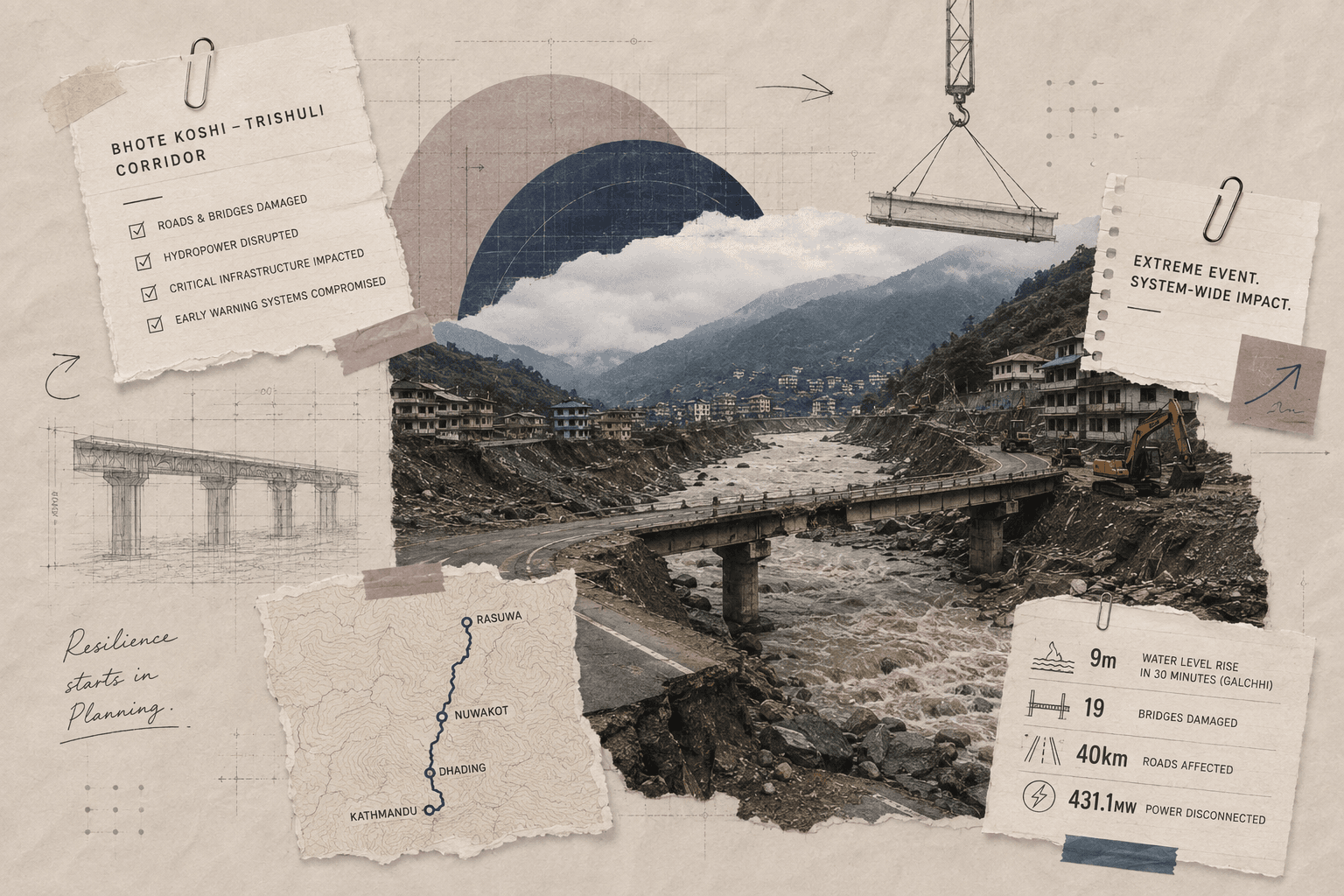
On August 26, 2026, a sudden flood struck Nepal’s Rasuwa district near the border with China. Water from the Lhende and Bhote Koshi river system moved downstream through the Trishuli corridor, damaging settlements and critical infrastructure in Rasuwa, Nuwakot and neighbouring districts.
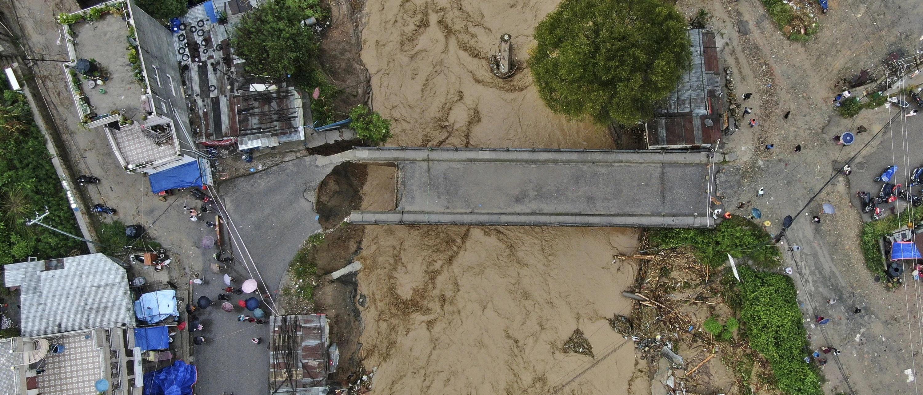
Nepal Police reported 95 deaths by Wednesday evening, while hundreds of people remained unaccounted for. Across Nepal and the Chinese side of the border, the combined reported death toll had reached 98. The figures were still evolving as search and rescue operations continued.
The infrastructure damage was substantial. Nepal’s Department of Roads reported damage to at least 19 bridges and approximately 40 kilometres of roads along the Trishuli corridor. The affected network includes routes connecting settlements in the region with the Rasuwagadhi border crossing.
The electricity sector was also affected. Nepal Electricity Authority reporting indicated that 11 hydropower projects and one solar facility were affected, with 431.1 MW disconnected from the national grid. Six hydropower plants and the solar facility sustained direct damage, while other plants were disconnected because of the condition of the surrounding transmission system.
The speed of the flood is particularly relevant to infrastructure planning. ICIMOD reported that water levels at Galchhi on the Trishuli rose by as much as nine metres in 30 minutes, while the rise at Malekhu was around seven metres over a similar period. Several hydrological monitoring stations were damaged or washed away.
These figures indicate that the event was not simply a case of individual structures failing under flood loading. Multiple infrastructure systems were affected within the same corridor, creating dependencies between transport, power, communications, emergency response and border connectivity.
That has implications for how projects are planned, designed and managed.
The event was driven by a rapidly developing mountain hazard
The exact sequence that produced the flood remains under investigation. ICIMOD and partner institutions have identified an ice-rock avalanche in the high-altitude Lhende Khola catchment as a likely trigger. Preliminary assessments indicate that a large volume of ice and rock debris may have entered the river, potentially creating a temporary blockage before water and sediment were released downstream.
Scientists are also examining unusual seismic signals recorded around the time of the event. A magnitude-4.4 seismic event was initially reported near the affected area, but ICIMOD has said that no causal relationship between seismic activity and the flood has been established. It is possible that some of the observed signals were associated with the suspected mass movement itself.
A glacial lake outburst flood has also been considered as part of the investigation. At this stage, the evidence does not justify assigning the disaster to a single mechanism with certainty.
For infrastructure planners, that uncertainty is significant. A project cannot always be designed around one precisely defined failure scenario in mountainous environments. Hazard assessment needs to consider combinations of avalanche, landslide, temporary river blockage, debris flow and flood conditions where the local geology and terrain make those interactions plausible.
The requirement is not to predict the exact event. It is to understand the consequences of several credible events and identify which project components are most exposed under each scenario.
That process should begin during feasibility and detailed project preparation rather than after construction.
Risk assessment needs to be connected to design decisions
Infrastructure projects generate large volumes of technical information during planning. A road project may include topographic surveys, geotechnical investigations, hydrological studies, traffic assessments and environmental analysis. A hydropower project may add geological mapping, flood studies, seismic assessments and river modelling.
The usefulness of these studies depends on whether they change the design.
For a road in a steep river valley, that could affect alignment, drainage, slope protection, bridge locations and alternative access routes. For a hydropower project, the same assessment may affect the location of the powerhouse, intake, switchyard, control room, transmission connection and access road.
The August 26 flood demonstrates why these decisions cannot be assessed only at the individual-asset level.
A hydropower facility may remain physically intact while its access road is destroyed. A bridge may remain structurally stable while its approach road is cut. A substation may be above the flood level while its transmission connection is damaged. Each asset can meet its own design criteria and still become unavailable because another part of the network has failed.
This is a network dependency problem.
For DPR preparation, the implication is straightforward: risk studies should identify not only direct asset exposure but also the consequences of failure elsewhere in the corridor.
Brenman’s existing guidance on Detailed Project Reports already places surveys, hydrological and geotechnical information, cost estimates, risk mitigation and tender documentation within the project preparation process. The Nepal event illustrates why those inputs also need to be connected to asset dependencies and recovery requirements.
The corridor matters because infrastructure is interdependent
The Bhote Koshi–Trishuli corridor contains several types of infrastructure within a relatively constrained geography. Roads follow river valleys, bridges provide crossings, hydropower projects depend on the river and on road and transmission access, and settlements and border facilities depend on the same transport network.
A disruption in one part therefore affects several other functions.
The road damage is not simply a 40-kilometre reconstruction requirement. It affects movement of residents, emergency responders, construction crews, equipment and supplies. Damage to 19 bridges reduces the number of available crossings and may isolate road sections that remain physically undamaged.
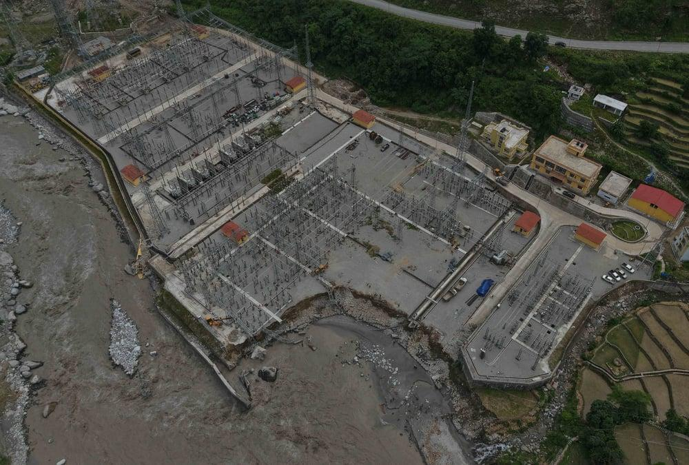
The power impact follows a similar pattern. The reported 431.1 MW disconnected from the grid does not mean every megawatt of capacity was physically destroyed. Some projects were disconnected because transmission infrastructure or operating conditions were affected.
That distinction is important for recovery planning because physical reconstruction and system restoration are different tasks.
Replacing a damaged turbine component requires one set of resources. Restoring a transmission connection requires another. Reopening a road may be necessary before either can happen.
Project planning should therefore identify critical dependencies between packages and assets. In large infrastructure programmes, this information can be incorporated into the project WBS, schedule logic, risk register and asset information model rather than being maintained separately by different teams.
A WBS, for example, already provides a structure for linking work packages, costs, schedules, resources and responsibilities. Extending that structure to include critical dependencies can make it easier to identify which external assets could affect the delivery or operation of a package.
Early warning is an infrastructure function, not an add-on
The nine-metre rise recorded at Galchhi in 30 minutes illustrates the value of lead time. A conventional emergency response relies on people receiving information, understanding the warning, making a decision and moving to safety. When water levels change that quickly, those steps need to be supported by automated monitoring and predefined operating procedures.
This is particularly important for remote mountain infrastructure.
Potential monitoring systems include river-level gauges, weather stations, cameras, seismic instruments, ground-movement monitoring and satellite observations. Their value increases when the information is integrated into a warning chain that can trigger specific actions.
For example, an abnormal upstream signal could be connected to alerts for downstream communities and facilities. Hydropower operators could receive predefined shutdown instructions. Road authorities could restrict access to exposed sections. Emergency teams could be directed towards predefined assembly points and alternative routes.
The architecture needs redundancy as well.
ICIMOD reported that several monitoring stations were damaged or washed away during the flood, although the Galchhi station remained operational.
This means the monitoring network itself should be treated as critical infrastructure. Sensors in the most exposed locations need redundancy or alternative observation methods. Communications should have backup power and, where practical, multiple transmission paths. Warning centres should not depend on a single physical connection.
A monitoring system that stops functioning when the hazard reaches the asset it is monitoring has limited value. Designing for sensor failure and communications loss should therefore form part of the original system architecture.
The 2025 flood provides an important baseline
The same broad corridor experienced a major flood in July 2025.
Nepal’s National Disaster Risk Reduction and Management Authority reported that the July 8 event was associated with the rapid discharge of a supraglacial lake on the Purepu Glacier in Tibet. The flood destroyed the Nepal-China Friendship Bridge at Rasuwagadhi, damaged hydropower infrastructure and disrupted the road between Syabrubesi and Rasuwagadhi.
The 2026 event appears to involve a different upstream mechanism, and the scientific investigation is still underway. The relevance of the 2025 event is therefore not that it proves the latest flood was predictable.
Its relevance is that the corridor had already experienced a severe cross-border flood within the previous 14 months.
That creates a clear requirement for post-event learning. Damage assessments should be incorporated into hydrological and geotechnical databases, design assumptions should be reviewed, vulnerable sections should be remapped and emergency access arrangements should be tested against what actually occurred.
The process is similar to how project teams use lessons learned after construction defects, schedule failures or commissioning problems. The difference is that the event affects an entire infrastructure corridor rather than a single contract package.
Economic feasibility should include disruption costs
Resilience is often discussed as an additional engineering cost. That framing is incomplete because it considers the cost of prevention but not the cost of failure.
A bridge may cost more if it requires higher flood clearance, additional scour protection or stronger foundations. A project may also require an alternative access route, backup communication equipment or a more distributed power system.
Those measures increase initial capital expenditure.
They can also reduce future disruption.
Brenman’s work on economic feasibility emphasises cost-benefit analysis, sensitivity analysis, opportunity cost and the need to test infrastructure investments against different assumptions rather than relying on a single expected scenario.
The same principle applies to climate and hazard resilience.
A resilience measure should be evaluated against the probability and consequences of failure. The calculation can include direct repair costs, business interruption, loss of access, emergency response costs, revenue disruption and the time required to restore service.
This approach avoids a blanket assumption that every asset must be built to the highest possible level of protection.
A strategically important bridge may justify substantial additional protection because its failure would isolate multiple communities and project sites. A lower-use structure may be better served by an alternative route or a rapid-replacement strategy.
The appropriate solution depends on the asset’s role within the network.
Hydropower illustrates why asset-level protection is not enough
The reported impact on the power sector provides a useful example of this distinction.
Nepal has built significant hydropower capacity in mountain valleys because the geography offers high gradients and large river flows. The same geography also concentrates roads, transmission lines, construction access and generation facilities within narrow corridors.
Protecting the powerhouse alone cannot eliminate network risk.
A project may require flood-resistant intake structures and debris management, but it also needs reliable access to the site, protected electrical equipment and a transmission system that can continue operating when one route is damaged.
This suggests that resilience reviews should be conducted across the entire chain from generation to transmission and access.
The same principle applies to other infrastructure sectors. A hospital is only useful if it retains access, water, power and communications. A border facility requires road connectivity, power and communications. A construction project requires the transport links needed to move equipment and materials.
Each asset has a physical footprint, but its operational footprint is much larger.
Construction planning also needs to reflect corridor risk
Risk does not end when the permanent design is completed.
Large construction sites in remote mountainous areas depend on temporary infrastructure: access roads, worker accommodation, material storage, batching facilities, fuel storage, temporary power and communication systems.
The Nepal flood shows why these temporary arrangements should form part of emergency planning.
A project site may have a detailed safety plan while the nearest approach road remains vulnerable to a flood. Worker camps may be located outside the permanent project footprint but inside a broader hazard zone. Heavy equipment may be available on site but unusable if the road required to move it has failed.
For contractors and project managers, this translates into practical requirements: identify alternative evacuation routes, map external infrastructure dependencies, maintain emergency communication, establish procedures for access loss and determine which materials and equipment need to be positioned locally.
These are project execution decisions, but they should be visible during project planning.
The next step is corridor-level risk mapping
The information required to manage this type of risk already exists across several disciplines.
Hydrological teams have river observations. Geotechnical teams have terrain and slope data. Roads agencies have bridge and pavement inventories. Power utilities have generation and transmission asset maps. Telecommunications companies have network information. Emergency authorities have response plans.
The problem is often that these datasets are managed separately.
A corridor-level risk model can combine them.
GIS can show which communities and assets lie downstream of a potential failure point. A digital model can show which roads become inaccessible if a bridge is lost. Asset databases can identify which hydropower plants depend on a particular transmission corridor or access road. Satellite monitoring can update physical conditions over time.
This is one area where BIM and digital asset management can extend beyond the construction phase.
The objective is not to create another software platform for its own sake. It is to maintain a common representation of the infrastructure system that can support design, construction, operations and emergency decisions.
The value is greatest when the information is linked to actual procedures.
A map showing a bridge location is useful.
A map showing that the bridge is the only practical route to three settlements, two hydropower sites and a medical facility is much more useful.
Resilience should be treated as a project requirement
The August 26 flood will continue to generate new information as authorities complete damage assessments and scientists analyse remote-sensing, hydrological, seismic and field data. ICIMOD has specifically cautioned that it is too early to determine the role of climate change in this individual event, even though glaciers, snow conditions, permafrost and mountain slopes across the Hindu Kush Himalaya are changing.
Those scientific conclusions should inform future risk assessments, but infrastructure decisions do not need to wait for every uncertainty to disappear.
The immediate planning lessons are already clear.
Project teams should identify critical external dependencies during feasibility and DPR preparation. Hydrological and geotechnical studies should consider plausible compound hazards where appropriate. Monitoring systems should be designed with redundancy. Emergency access and recovery logistics should be incorporated into project plans. Cost-benefit analysis should account for disruption and reconstruction, not only initial capital expenditure.
Most importantly, infrastructure should be assessed as a network when the performance of one asset depends on several others.
The flood in Nepal demonstrates why this matters. Damage to 19 bridges and 40 kilometres of roads affects far more than transport. The disconnection of 431.1 MW affects more than electricity generation. A damaged communications link affects more than telecommunications. Each disruption changes the ability of the wider system to operate and recover.
For the AEC industry, the practical implication is straightforward: resilience needs to be visible in the project documents that determine what gets built.
It should appear in the risk assessment, feasibility model, DPR, design basis, WBS, schedule, emergency plan and asset-management strategy.
The Nepal flood is a severe example of why those documents need to describe not only the infrastructure being built, but also the conditions under which that infrastructure is expected to operate and recover.